


Published: 11 March 2026 The English Chronicle Desk The English Chronicle Online – UK News
Scotland is bracing for a fresh wave of severe weather as the Met Office issues multiple yellow warnings for gale‑force winds and heavy rain, with gusts expected to reach up to 80mph in exposed areas. The warnings, covering much of the country, are in force through Wednesday and Thursday, raising fears of travel disruption, flooding and power outages.
The turbulent conditions are being driven by an active weather front sweeping southeast across the UK. Forecasters say the system will bring prolonged periods of heavy rain combined with powerful winds, creating hazardous conditions across central, western and northern Scotland.

The first yellow warning, in place until midday Wednesday, covers the Highlands and Islands, Argyll and Bute, and Orkney. Severe gales are expected across the Outer and Inner Hebrides before moving to the north‑west mainland. Gusts could reach 65–70mph, with a small chance of 75–80mph in a few locations. Rain and blustery showers will accompany the winds, adding to the risk of disruption.
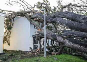
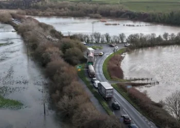
Forecasters caution that travel delays are likely across roads, railways, ferries and airports. High‑sided vehicles are particularly vulnerable on exposed routes and bridges, while coastal communities face dangerous waves and heavy sea spray.
A second yellow warning comes into force on Thursday, covering a wide swathe of Scotland including Central, Tayside & Fife, Grampian, South West Scotland, Lothian & Borders, and Strathclyde. Winds are forecast to reach 50–55mph widely, with peaks of 70mph in coastal areas.
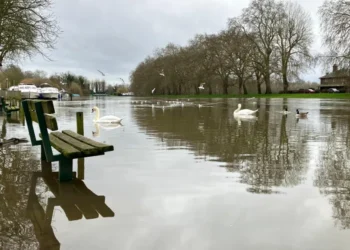
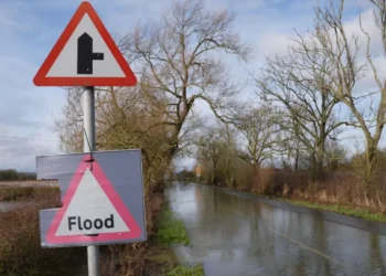
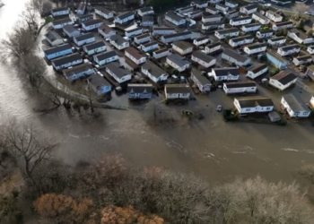
WX Charts indicate parts of Scotland could see up to 56mm of rain on Thursday, raising the risk of localised flooding. The combination of intense rainfall and strong winds is expected to cause widespread travel disruption, with commuters advised to plan for longer journey times.
Met Office forecaster Clare Nasir said: “A yellow wind warning is in effect for northern and western Scotland from midnight, expecting gales or severe gales of 50 to 60mph. Expect it to remain blustery in the morning, with showers across Northern Ireland, Scotland and the west country. Some brighter skies in between showers for the south, but increasing cloud elsewhere.”
The Thursday warning covers:
- Central, Tayside & Fife: Angus, Clackmannanshire, Dundee, Falkirk, Fife, Perth and Kinross, Stirling
- Grampian: Aberdeen, Aberdeenshire
- South West Scotland, Lothian & Borders: Dumfries and Galloway, East Lothian, Edinburgh, Midlothian, Scottish Borders, West Lothian
- Strathclyde: East Ayrshire, East Dunbartonshire, East Renfrewshire, Glasgow, North Ayrshire, North Lanarkshire, South Ayrshire, South Lanarkshire
Forecasters warn of:
- Travel disruption across road, rail, air and ferry networks
- Short‑term power outages in exposed areas
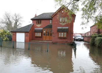
- Flooding risks from heavy rain, particularly in low‑lying regions
- Dangerous coastal conditions with large waves and heavy spray
Residents are advised to secure outdoor items, avoid unnecessary travel during peak winds, and check local updates before setting out. Emergency services are on alert, with councils preparing flood defences and transport operators warning of delays.

The warnings come amid a winter of unsettled weather across the UK, with multiple storms bringing flooding and disruption. Climate experts note that extreme weather events are becoming more frequent, underscoring the need for resilience planning.
For Scotland, the latest warnings highlight the vulnerability of transport infrastructure and coastal communities. With gusts approaching hurricane strength in some areas, the next 48 hours will test preparations and emergency responses.
Scotland faces a challenging week as gale‑force winds and intense rain sweep across the country. With warnings in place for both Wednesday and Thursday, residents and travellers are urged to remain vigilant, plan ahead and heed official advice.
Related News:
 Dozens of Flood Warnings in England After Days of Non-Stop Rain
 Flooding May Worsen Before It Improves as More Rain Forecast for the UK
 Storm Hernando: Edinburgh Airport Flights Cancelled in US Travel Chaos
 Storm Hernando: Edinburgh Airport Flights Cancelled in US Travel Chaos
 UK Winter Nowhere Near a Record Breaker Despite Floods and Storms
 UK Records Warmest Day of the Year as Temperatures Exceed 18 °C
 Farmers on Edge as Record Rainfall Dampens Slurry Season
 “Enough is Enough”: Local MP Vows to Fight Rainham Quarry Plans
 Man Escapes as Giant Hole Swallows Boats on Shropshire Canal
 Heat, Drought and Fire Push UK Nature to Breaking Point in 2025
 UK Snow Forecast Arctic Blast to Bring Up to 11 Inches of Snow
 Norfolk Coastal Graves at Risk as Erosion Deepens Family Anguish
 Record Wildfires Sweep England Amid Hottest 2025 Summer
 Winter plant bloom signals climate breakdown in UK
 Dog Food Emissions: 1% of UK Greenhouse Gas Revealed
 Local Fish Could Boost UK Health and Economy Significantly
 World’s richest 1% consume annual emissions in just ten days
 Storm Goretti leaves Cornwall homes without power
 Robo-Vaccination Could Transform Fight Against Bovine TB
 Kent Residents Continue Facing Water Supply Disruptions
 Water firms may avoid fines under UK water reform plan
 No Gas Boiler Ban as UK Warm Homes Plan Backs Heat Pumps
 Judi Dench Champions Fight to Save London’s Green Spaces
 Red Meat Politics: Farage and Truss’ Quiet Mayfair Lunch
 UK joins North Sea wind grid pact with nine European nations
 Devon hosts first high-density hydro power system
Storm Chandra floods Somerset, triggers major incident declaration
Devon hosts first high-density hydro power system
Storm Chandra floods Somerset, triggers major incident declaration
 Storm Chandra flooding leaves England on high alert
 UK Pfas Action Plan Faces Criticism From Environmentalists
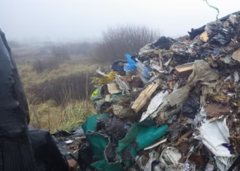
 Wigan Dump Crisis Sparks Health and Safety Alarm
 What is Groundwater Flooding and Why Dorset is Seeing ‘Historical Highs’
 Fish disco plan could save 90% of fish at Hinkley C
 UP IN FLAMES: Huge Blaze Rips Through Odeon Cinema, Students Evacuated
 Temperatures Dip Below Freezing as Arctic Air Sweeps Across the UK
 Fast-moving Wildfires Rage Across Southwestern US
 Snow and Rain Warnings as Cold Snap Continues in the UK
 Flood risk homes surge across England builds
 Shutting North Sea ‘Will Drive Up Carbon Emissions’
 Deer Shooting England: New Plan to Protect Woods
 Illegal Waste Dumping: New Drone Unit Launched
 Break from Wintry Weather as UK Temperatures to Climb to 14 °C
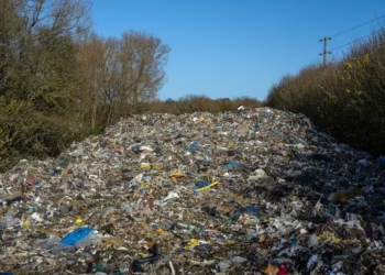 Fly-Tippers to Be Hunted by ‘Drone Squad’ in Crackdown from the Sky
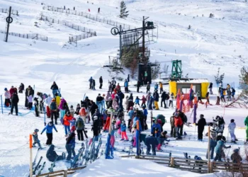 Bumper Ski Season but Avalanches Threaten Scotland’s Snowy Hills
 Deer Shooting to Be Facilitated in England to Protect Woodlands
 Bodies of Man and Boy Found in Burnt‑Out Car After Horror Crash in the Highlands
 South Lanarkshire Council Helps Mark Care Day 2026
 Karen Gillan Reveals What She Misses Most About Scotland’s Food and People
 SNP Charging £750 per Ticket for Business Event Featuring ‘Beer and Blether’ with Stephen Flynn
 ‘Mountain Rescue Gives Incredible Satisfaction’
 One in Four Councils to Miss Food Waste Collection Deadline
 Spring‑Like Warmth to Peak on Wednesday with 18 °C Forecast
 Rubbish Investigators Search Fly‑Tips for Clues in Waste Crime Crackdown
 Why I Rinse My Recycling and Give It to My Mum
 Group Expands Legal Claim Over South West Water Pollution
 Scotland’s Climate Plans Face Scrutiny Over ‘Science Fiction’ Targets
 Police Appeal After Goshawk ‘Brutally Shot’
 Miliband Says Climate Impact of Data Centres Is Uncertain
 Conservation Budgets Hit by Increased Fly‑Tipping Costs
 Sir John Curtice: Which Issues Will Decide the Elections
 Water Cremation Introduced in UK First
 Crowing Cockerels Must Be Silenced, Council Warns Owner
 Scotland Becomes First UK Country to Allow Water Cremations
 New Infection Risk Alert at Glasgow’s Flagship Hospital
 Wood burner legal threats spark council row
 South East Water Fined £22.5m for Repeated Supply Failures
 Yorkshire Water Funding Sparks Debate Amid Fines and Pay Row
 Woman dies after horror two-vehicle crash in Scots town
 Fan Chief Condemns ‘Shameful’ Violence After Rangers–Celtic Chaos
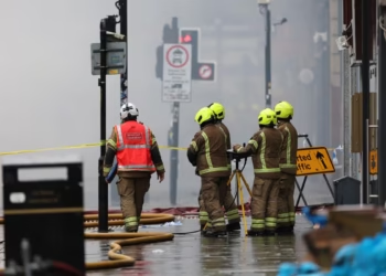 Glasgow Blaze ‘Like the Blitz’ as Fire Ravages Building Near Central Station
 Swinney: ‘Enormous’ Damage After Blaze Near Glasgow Central
 Dramatic Rescue as Ice Shelf Detaches on Lake Huron
 Glasgow Central Fire Sparks Days of Disruption
 Scots Man Convicted in Dirty Money Case After DNA Found on Cash
 Man Arrested Over Gunshot Death in Motherwell
 Net Zero Cheaper Than One Fossil Fuel Crisis, UK Told
 CCTV Shows Limping Man Missing Nine Days as Police Appeal
 Man Dies in Glasgow Flat Fire as Police Probe ‘Unexplained’ Death
 Glasgow Central’s Upper Level Shut All Week After Union Street Fire
 Teen Wins Payout After TRNSMT Crush Horror
 Birmingham Bin Strike Enters Sixth Month as Negotiations Stall


