

Published: 30 March 2026. The English Chronicle Desk. The English Chronicle Online.
The vast and typically arid landscapes of the Arabian Peninsula have just endured a week of atmospheric turbulence that has left meteorologists and residents alike in a state of disbelief. An extraordinary weather pattern has unleashed a series of severe thunderstorms across the United Arab Emirates and Saudi Arabia, turning sun-drenched cityscapes into waterlogged zones. These countries are more accustomed to the relentless heat of the desert sun than the violent drenching they received over the past several days. Experts noted that the region received up to 150mm of rain in a startlingly short window of time. Such figures are virtually unheard of for this part of the world during the spring transition. The sheer volume of water has tested the limits of modern infrastructure and left many communities struggling to cope with the aftermath.
This sudden and dramatic deluge was primarily triggered by an abnormally strong jet stream located high in the atmosphere. This high-velocity river of air helped to cultivate a deep area of low pressure that settled just north of Saudi Arabia. As this system matured, it began to act like a giant atmospheric pump, drawing moist tropical air from the Indian Ocean. When this warm, wet air collided with cooler conditions over the peninsula, it sparked a chain reaction of intense and sustained storm cells. The complexity of this system was further enhanced by a shift in wind patterns that created significant instability. This resulted in the kind of weather more commonly associated with the American Midwest than the Middle Eastern desert. Forecasters have spent much of the last week monitoring these developments with growing concern for public safety.

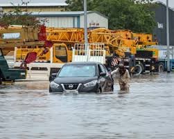
The impact was felt early and with significant force in Oman, where the weather took a turn for the extreme. Residents in several regions reported hailstones falling with such velocity and size that they were compared to tennis balls. These icy projectiles accompanied torrential rain that quickly overwhelmed local drainage systems and turned dry wadis into raging torrents. By the middle of the week, the capital of Qatar, Doha, was also grappling with the effects of the storm system. Flooding was reported in various parts of the city as the ground became saturated and unable to absorb any more moisture. The visual of luxury cars navigating through deep pools of standing water became a common sight on social media feeds. This early phase of the storm set a grim precedent for what was to follow as the system moved east.
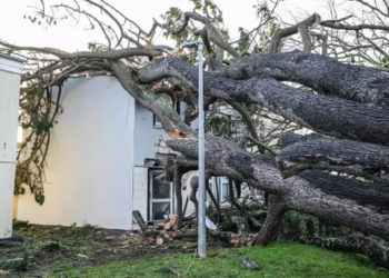
By Thursday evening, the weather situation became even more organized and dangerous as a formidable line of storms took shape. This weather front swept across the United Arab Emirates, targeting some of the most densely populated urban centers in the world. Dubai and Abu Dhabi bore the brunt of the onslaught as the sky turned a bruised purple and lightning lit up the skyline. Wind gusts were clocked at speeds reaching 80mph, which is powerful enough to cause significant structural damage and uproot trees. The frequent and intense lightning strikes provided a dramatic but terrifying backdrop to the heavy rainfall that followed. Roads that are usually bustling with traffic were transformed into temporary rivers within a matter of hours. Authorities were forced to issue urgent stay-at-home orders to ensure the safety of the general public.
While thunderstorms are not entirely absent from the region’s climate history, the nature of this event was truly exceptional. Many residents still hold vivid memories of the extreme flooding that paralyzed Dubai in April 2024. However, that event was largely a singular, massive burst of rain rather than a sustained multiday siege. The persistence of the current storm system is a characteristic more often seen in the central plains of the United States. This unusual longevity meant that areas already weakened by initial rains were hit repeatedly by subsequent waves of water. Meteorologists have pointed out that such patterns are becoming increasingly frequent as global temperatures continue to climb. The atmosphere is now holding more moisture, which provides more fuel for these massive convective events. It is a reality that desert nations are now having to accept as the new normal.
The data gathered from various weather stations across the region tells a story of unprecedented precipitation levels. On Jebel Yanas, a peak in the northern mountains of the UAE, a staggering 244mm of rain was recorded. To put that figure into perspective, it represents more than double the average annual rainfall for the entire country. Many other urban and rural stations reported totals exceeding 100mm, far surpassing what is typically expected in a single year. These numbers highlight the severity of the atmospheric shift that occurred over the peninsula last week. The environmental stress caused by such a sudden influx of water cannot be overstated for a desert ecosystem. It has sparked a wider conversation about the need for enhanced flood defenses in regions historically designed for drought. The financial cost of the damage is expected to be substantial as recovery efforts begin.
As the storms over the Arabian Peninsula finally begin to dissipate, the focus of meteorologists is shifting elsewhere. A new and developing low-pressure system is currently gathering strength in the Mediterranean, southeast of the coast of Italy. This system is projected to bring another round of heavy rain and thunderstorms to parts of southeastern Europe. Countries such as Greece and Turkey are expected to be in the direct path of this emerging weather threat. Forecasters are warning that rainfall totals could reach significant levels on Tuesday and Wednesday of this week. This brings a renewed risk of flash flooding and landslides in mountainous regions and coastal towns. Residents in these areas are being urged to keep a close eye on official weather warnings. The volatility of the spring season seems to be showing no signs of slowing down just yet.

The potential for disruption extends beyond just heavy rain, as high winds are also a major concern for the coming days. Gusts of between 60mph and 80mph are expected to affect several countries along the northern coast of Africa. Libya is particularly vulnerable, having already been battered by a similar system known as Storm Samuel earlier this month. The recurrence of such powerful wind events is causing significant anxiety for communities still trying to repair previous damage. These storms are not just isolated weather events but part of a larger, more complex global climate puzzle. Each new record-breaking deluge serves as a reminder of how quickly our environment is changing around us. The predictability of seasonal weather appears to be a thing of the past as extremes become more common. International relief agencies are staying on high alert as these systems continue to track across the map.
Back in the United Arab Emirates, the cleanup operation is expected to take several weeks to complete. Emergency crews have been working around the clock to pump water from submerged tunnels and major highways. The resilience of the local population has been on full display as neighbors help one another clear debris. Despite the chaos, there is a sense of relief that the worst of the atmospheric instability has passed for now. However, the long-term implications for urban planning and disaster management will be debated for a long time. Engineering firms are already looking at ways to improve the capacity of drainage networks in Dubai and Abu Dhabi. There is an urgent need to ensure that the infrastructure can withstand the next inevitable “thousand-year” storm. For now, the desert sun has returned, but the landscape remains a vivid testament to the power of nature.
Related News:
 ‘Extinct’ Antelope Returns to Sahara, Bringing Hope
 Norfolk Coastal Graves at Risk as Erosion Deepens Family Anguish
 Eden Project Founder Celebrates 25 Years of Nature’s Hope
 Winter plant bloom signals climate breakdown in UK
 UK Homes May Skip Batteries in New Green Rules
 Avocado Crisis: The Hidden Violence Behind Exports
 Smaller farms funding prioritised in England nature plans
 Dog Food Emissions: 1% of UK Greenhouse Gas Revealed
 Dutch Nationwide Fireworks Ban Expected to Transform New Year Traditions
 Storm Goretti leaves Cornwall homes without power
 Wildlife Targets at Risk in England and Northern Ireland
 Dubai Chocolate Craze Inspires South Korea’s Latest Dessert Obsession
 Traces of Glyphosate Found in UK Playground Tests
 BP’s Influence Sparks Controversy in UK STEM Education
 Polycrisis Anxiety Leaves Many Feeling Trapped in the Present
 Japan Prepares for Kashiwazaki Restart After Fukushima Legacy
 Kent Residents Continue Facing Water Supply Disruptions
 Water firms may avoid fines under UK water reform plan
 Antarctic Penguins Shift Breeding Season Amid Climate Change
 No Gas Boiler Ban as UK Warm Homes Plan Backs Heat Pumps
 Judi Dench Champions Fight to Save London’s Green Spaces
 Half the World’s Largest Cities Face Rising Water Stress
 The Sound of Mayhem’: Terror and Loss at Mount Maunganui
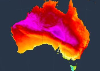 Record-Breaking Heat Looms Over South-East Australia as Catastrophic Fire Risk Escalates
 Reindeer Deaths Rise as Finnish Herders Blame Border Wolves
 UK joins North Sea wind grid pact with nine European nations
 Devon hosts first high-density hydro power system
 US-Style Pickup Trucks Surge on UK Roads
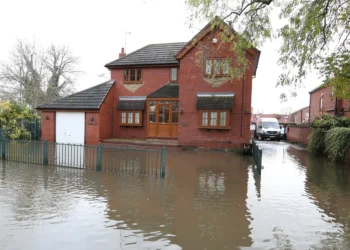
 Storm Chandra floods Somerset, triggers major incident declaration
 How Sandhill Ashes Rebuilt a Bushfire-Hit Rural Community
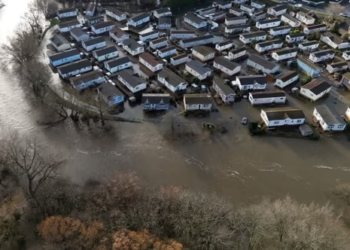 Storm Chandra flooding leaves England on high alert
 Reform UK Taps Boris Ally to Shape Party Nature Agenda
 James Valentine Retires from ABC After Cancer Battle
 UK Pfas Action Plan Faces Criticism From Environmentalists
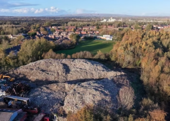 Wigan Dump Crisis Sparks Health and Safety Alarm
 Norway’s Petrol Car Sales Hit Record Low Amid EV Surge
 Fish disco plan could save 90% of fish at Hinkley C
 Santos Wins Landmark Greenwashing Case in Court
 Gentoo Penguins First Birds on Australian Territory Hit by Bird Flu
 AI Climate Claims Face Greenwashing Backlash
 Flood risk homes surge across England builds
 Chikungunya Spread in Europe Climbs as Climate Warms
 Deer Shooting England: New Plan to Protect Woods
 Illegal Waste Dumping: New Drone Unit Launched
 Scotland’s Emissions Plans Face Criticism for Over-Reliance on Technology
 Germany Faces Backlash Over Scrapped Renewable Heating Mandate
 Group Expands Legal Claim Over South West Water Pollution
 Scotland’s Climate Plans Face Scrutiny Over ‘Science Fiction’ Targets
 Humans – not Mimmo the dolphin – need managing in Venice lagoon
 Ocean Warming Drives Massive Marine Life Loss, Study Warns
 Ancient Stepwells Revived Amid India’s Deepening Water Crisis
 Tropical Flowers Shift Blooming Due to Climate Crisis
 Death Valley Blooms Signal Potential Superbloom Year
 Greenpeace $345m Ruling Sparks Appeal Battle
 Save the Caterpillars to Help UK Moth Populations Grow
 Wood burner legal threats spark council row
 South East Water Fined £22.5m for Repeated Supply Failures
 Yorkshire Water Funding Sparks Debate Amid Fines and Pay Row
 Net Zero Cheaper Than One Fossil Fuel Crisis, UK Told
 Musk’s xAI Permit Sparks Fury Over Power Plant Expansion
 Welsh Water Faces £44.7m Enforcement Over Sewage Breaches
 London Considers New SUV Charges to Improve Road Safety
 The Truth Behind Rising Energy Costs and Fossil Fuel Myths
 ‘Drinking from a Fetid Pond’: Superbug Genes in Lough Neagh
 New £10bn rescue plan offered for Thames Water
 MPs Slam Agency Over Failing Fight Against Waste Dumping
 Extreme Weather: Europe Shivers as Cyclone Narelle Hits
 Scottish Government Mandates Single-Sex Toilets and Changing Facilities in Schools
 Reeves Faces Setback as Labour May Miss Homes Target
 Kate Winslet to Narrate Film Highlighting King’s Environmental Mission
 Trump’s UK Ambassador Urges North Sea Drilling to Strengthen US Ties
 UK Bans Fake Numbers: Scammers Lose Their Trick
 UK Job Vacancies Hit Five-Year Pandemic Low
 UK Youth Unemployment Surges Amid Tax Changes
 Half of Britons Avoid GP When Ill, Survey Reveals Growing Concern
 Russian Trade Routed Through British Islands Exposed
 Stewart Brand on Musk, Bezos and a Life of Long Thinking
 Hilary Knight speaks out on Trump’s recent hockey remarks
 Mother Says ‘I Hugged My Daughter’s Killer’ as They Cried Together in Prison
 Penny Wong silent on Australian crew in sub strike


