

Published: 03 March 2026. The English Chronicle Desk. The English Chronicle Online.
Australia wettest summer has delivered a season of striking climate contrasts. The country endured fierce heatwaves before torrential rains reshaped entire regions. According to the Bureau of Meteorology, the 2025–26 season became the wettest in nearly a decade. Rainfall nationwide sat 32 per cent above the long-term average. It marked the rainiest summer since 2016–17, surprising many climate observers.
At the same time, the season ranked as Australia’s eighth-hottest on record. Average temperatures stood 1.1 degrees Celsius above the 1961–1990 baseline. The blend of record heat and soaking rain defined Australia wettest summer. Communities felt both extremes within weeks of each other.
Climatologist Qian Zhou explained that only one twentieth-century summer surpassed this heat. That year was 1997–98, which measured 1.11 degrees above average. Apart from that season, nine of the ten hottest summers have occurred since 2012–13. The data reinforces how recent decades have dominated temperature records.
Late January delivered the most intense heat of the season. Sixty-two weather stations recorded their highest-ever daily maximum temperatures. These records were set between 26 and 31 January. Several towns endured conditions rarely experienced in modern times.

South Australia witnessed some of the harshest temperature spikes. The state experienced its fourth-hottest summer overall. Andamooka recorded 50 degrees Celsius on 29 January. Port Augusta matched that figure one day later. Such readings highlight the severe extremes that punctuated Australia wettest summer.
The oppressive heatwave left residents seeking relief in cooled spaces. Emergency services warned vulnerable people to remain indoors during peak hours. Power grids strained under heavy air conditioning demand. The landscape dried rapidly under relentless sun and hot winds.
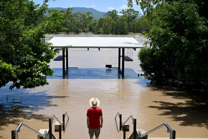
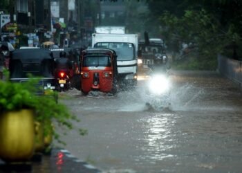
Yet the narrative changed dramatically as February arrived. Heavy rainfall swept across much of the country. Zhou noted that rainfall concentrated heavily during February. South Australia received extraordinary downpours after its scorching January.
In that state, February rainfall reached 356 per cent above average. It became the second-wettest February on record there after 2011. Large parts of the north-east experienced their highest-ever February totals. The reversal from drought-like dryness to flooding rain astonished many residents.
Several rain-bearing systems contributed to the surge. A lingering tropical low intensified precipitation across multiple regions. Moisture-laden air masses interacted with unstable conditions to generate widespread storms. Rivers swelled quickly after weeks of heat-baked ground.
Every state and territory except Tasmania recorded above-average February rainfall. Tasmania measured totals 17 per cent below its seasonal norm. Elsewhere, saturated soils replaced dusty paddocks almost overnight. The sharp shift became a defining feature of Australia wettest summer.
Associate Professor Andrew King of the University of Melbourne described the oscillation as remarkable. He explained that heatwaves and fires were followed by heavy rain and floods. Australian summers are traditionally volatile, he noted. However, climate change appears to intensify these swings.
King stressed that warming global temperatures increase fire weather severity. He also warned that extreme rainfall events are becoming more intense. Some parts of Australia already show stronger short-duration downpours. The pattern reflects broader global climate trends.
Night-time temperatures added another layer of concern. Nationally, average minimum temperatures ranked as the fifth-warmest on record. Some inland areas experienced their hottest summer nights ever measured. Western Australia and the Northern Territory were particularly affected.
Paraburdoo Aero in Western Australia recorded a minimum of 35.8 degrees. That reading on 7 January marked the nation’s hottest overnight temperature. Rosebourne registered 32.3 degrees in late December. Shark Bay recorded 28.9 degrees on 21 January.
Other states also broke night-time heat records. Gluepot Reserve in South Australia reached 32.6 degrees overnight. Paterson in New South Wales recorded 28.8 degrees. Mount Buller in Victoria set a record minimum of 21.2 degrees. These figures underscored how persistent the heat remained after sunset.
Warm nights can place additional strain on health and infrastructure. Without cooler evenings, bodies struggle to recover from daytime extremes. Hospitals and aged care facilities often report increased pressure during such events. The sustained warmth formed a crucial part of Australia wettest summer.
Despite widespread rain, some southern regions remained below average. Zhou acknowledged ongoing rainfall deficiencies in certain areas. Parts of southern Australia still face long-term moisture shortfalls. The uneven distribution shows that heavy rain does not solve all deficits.
Climate projections for autumn suggest further contrasts ahead. Northern Australia is likely to experience continued above-average rainfall. Southern areas may face drier conditions during the same period. Warmer-than-usual days and nights are forecast across most regions.
Authorities have also flagged increased fire risk in several states. Western Australia, South Australia, New South Wales and Victoria could see elevated danger. Vegetation growth after rain can later dry and fuel bushfires. This cycle adds complexity to emergency planning.
The season’s dual nature reflects broader climatic instability. Australia wettest summer demonstrated how extremes can coexist within one timeframe. Record heat did not prevent record rainfall weeks later. Instead, both unfolded in dramatic succession.
Communities adapted rapidly as conditions evolved. Farmers shifted from irrigation concerns to flood management strategies. Urban councils inspected drainage systems after intense downpours. Insurance providers monitored claims linked to heat damage and storm impacts.
Experts emphasise that climate data must guide future planning. Infrastructure resilience depends on understanding these evolving patterns. Roads, railways and power networks require design standards suited to extremes. Scientific monitoring remains central to national preparedness.
The Bureau of Meteorology continues to refine its seasonal outlooks. Advanced modelling integrates oceanic and atmospheric indicators. These tools aim to improve warnings for heatwaves and heavy rain. Public awareness campaigns also encourage proactive community responses.
While the statistics appear stark, many Australians responded with resilience. Volunteers supported neighbours during fire alerts and flood warnings. Local authorities coordinated cooling centres during peak heat. Such collective action softened the season’s harshest impacts.

Nevertheless, the data leaves little room for complacency. Nine of the ten hottest summers have occurred since 2012–13. Long-term warming trends remain evident across the continent. Australia wettest summer stands as another marker in that trajectory.
Scientists continue to examine how ocean temperatures influenced rainfall patterns. Warmer seas can inject additional moisture into weather systems. That process may intensify tropical lows and monsoon activity. Research into these drivers remains ongoing.
For many residents, memories of the season will linger. They recall searing afternoons followed by relentless storms weeks later. The contrast defined daily life across cities and rural towns alike. Australia wettest summer became a story of resilience amid extremes.
As autumn approaches, authorities urge vigilance and preparation. Weather variability will likely remain a central theme. Climate experts stress that adaptation must match accelerating change. The lessons from this season may shape responses for years ahead.
Related News:
 Top Christmas Books Reads: Classics to Cozy Romcoms
 Just Stop Oil Protesters Convicted Amid Climate Defence Row
 BBC to Apologise Over Edited Trump Speech Amid Backlash
 Britain deploys RAF specialists to assist Belgium with drone threats
 Palace May Restore Hyphen to Andrew Mountbatten-Windsor’s Name
 US Senate Passes Funding Bill to End Historic Shutdown
 US Justice Department Files Lawsuit Against California Over Partisan Voting Maps
 Greene Pushes Epstein Files Amid Trump Fallout
 Trump Deploys DHS to Charlotte in Major Arrest Operation
 December Run-Off in Chile as Election Produces No Winner
 Zelenskyy Signs Fighter Jet Deal Amid Russian Drone Attacks
 Orban Says Ukraine Has ‘No Chance’ as EU Support Continues
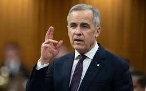 Canada Passes Carney’s First Budget in Tight Parliamentary Vote
 Israeli Strike Kills 13 Near Palestinian Camp in Lebanon
 Shadow Fleet at Sea: Europe’s Battle Against Illicit Oil Shipping
 Tiny Curacao Makes History as Smallest Nation to Reach World Cup
 Haiti Qualifies for World Cup Despite Coach Never Visiting Country
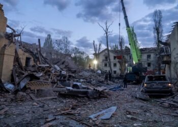 Deadly Russian Strikes Hit Western Ukraine, 20 Killed in Ternopil
 Pentagon Officials in Ukraine to Discuss War End
 Ukraine Peace Plan: Zelensky Ready for Dialogue
 Vietnam Battles Deadly Floods as Rains Continue
 Venezuela Threatens Nobel Winner Machado with Fugitive Status
 Royal Navy Shadows Russian Warships Entering the Channel
 US Suspends Afghan Immigration After White House Shooting
 Two National Guard Soldiers Critically Injured Near White House
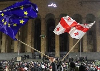 Georgians Defy Government Crackdown After Year of Protests
 Southern Lebanon reels as Israeli strikes shatter communities
 Sri Lanka Floods Leave 56 Dead, Dozens Missing
 Tokyo court rules Japan’s same-sex marriage ban constitutional
 ‘Extinct’ Antelope Returns to Sahara, Bringing Hope
 EU plans $105bn Ukraine aid using frozen Russian assets
 American Mother Extradited From UK to U.S. on Murder Charges
 Russia losses Ukraine war peace talks intensify amid rising deaths
 Facebook Slow to Remove Bondi Attack Praise, Anti-Hate Group Claims
 Australian Cruise Ship Freed After Reef Grounding in Papua New Guinea
 US Cities Erupt in Protests Against Trump’s Venezuela Military Action
 Albanese Opens Door to Bondi Royal Commission Amid Rising Pressure
 Trump Escalates Minnesota Immigration Surge Amid Rising Tensions
 Iran Protesters Defy Crackdown as Violent Clashes Intensify
 US Clears Nvidia AI Chip Sales to China in Policy Shift
 Trump Threatens Strong Action If Iran Executes Protesters
 Gulf states warn Trump Iran strikes risk wider Middle East war
 Machado Trump medal gesture reshapes Venezuela power struggle
 EU weighs response amid Greenland tariff crisis with Trump
 Syria President Declares Victory as Ceasefire Reached with SDF
 Sydney Shark Attack Surge Shocks Australia Beaches
 ICE street raids expose a chilling future for public freedoms
 Thousands Flee Cambodia Scam Centres Amid Global Pressure
 EU Says US Ties Have Suffered ‘Big Blow’ After Greenland Crisis
 Andrew Hastie Emerges as Leadership Rival to Ley
 Starmer China visit raises human rights pressure on Beijing
 US Launches Multi-Day Air Drills Amid Rising Iran Tensions
 Videos reveal earlier clash before Alex Pretti shooting
 China Executes 11 Linked to Myanmar Scam Networks
 UK New Car Discounts Near £6,000 as Prices Are Slashed
 Israel Moves to Bar MSF From Gaza Operations
 Tragic Ski Lift Accident Claims Australian Snowboarder
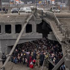
 Thousands Left Without Heating in Ukraine Amid Russia Strikes
 Trump Praises ‘Terrific’ Petro After White House Talks
 Portugal Election Delivers Socialist Win as Far Right Surges
 Sydney Protest Escalates and Elderly Woman Suffers Severe Injury
 Tarique Rahman’s Rise Toward Bangladesh’s Top Job
 Australian Families Leave Syrian Camp for Home
 SA Police Intensify Search in Gus Lamont Case
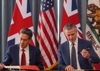 Trump Attacks UK-California Energy Pact
 Trump and Chagos Deal Rift Over Iran Strikes
 Andrew Arrest Sparks Republic Debate in Australia
 Global corruption crisis: Who Washington shields
 Farage Chagos Islands Row Sparks Fury
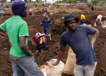 Gold Rush in Gugulethu Leaves South Africans Desperate for Work and Hope
 Greenpeace $345m Ruling Sparks Appeal Battle
 Hilary Knight speaks out on Trump’s recent hockey remarks
 Trump Speech Sparks Intense Debate Across Divided America
 Has Europe truly learned from the failures of 2022?
 Social Media Trial: Woman Says Addiction Began at Six
 Berlin Bunker Transforms Into Powerful Ukraine Museum
 UK Personnel Near Iranian Missile Strike in Bahrain
 Trump Faces Questions Over Iran Conflict Plan
 Iran Civilian Deaths Surge Past 200 Amid Fear
 US Iran Operation: Sixth Service Member Killed


