

Published: 19 November 2025 Wednesday . The English Chronicle Desk. The English Chronicle Online
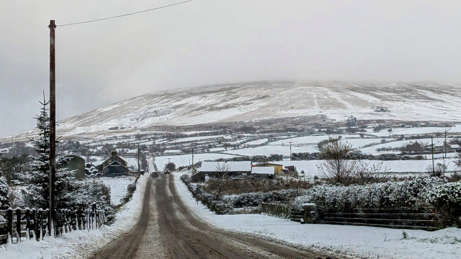
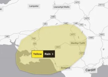
Northern Ireland is bracing for potentially disruptive weather as the Met Office has issued a yellow warning for snow and ice, which came into effect at midnight and will last until noon on Wednesday. The alert comes as strong northerly winds sweep across the UK and Ireland, ushering in a surge of Arctic air that is expected to bring sub-zero temperatures, frost, and icy conditions in many areas.
The Met Office has cautioned that commuters, particularly those travelling across higher routes, may encounter delays and hazardous conditions. While the majority of lowland areas are expected to see little or no snow, some elevated locations are likely to receive between 1 and 3 centimetres, with isolated spots possibly seeing accumulations of up to 5 centimetres. Roads such as the Glenshane Pass and Coleraine Mountain Road are among those expected to be most affected.
Meteorologists have highlighted that the current temperatures are unusually cold for this time of year, with daytime highs typically closer to 10°C in Northern Ireland. Wednesday and Thursday nights are expected to experience sub-zero temperatures, raising the risk of frost formation and icy patches, which could further exacerbate travel difficulties. Drivers have been urged to exercise caution, allow extra time for journeys, and take necessary precautions such as ensuring vehicles are winter-ready.
The combination of icy roads and heavy winds also poses a heightened risk for pedestrians and cyclists, who are being advised to dress appropriately and remain vigilant in conditions of reduced visibility. Public transport services, including buses and trains, may also experience delays due to snow and ice, particularly on routes that pass through hilly or rural areas.

The yellow warning issued by the Met Office represents the second tier of its four-level system, indicating that the weather could cause some disruption but is not expected to be life-threatening. Nonetheless, forecasters have warned that the potential for accidents and delays remains significant, especially during peak morning and evening travel periods.
Local authorities and emergency services have been preparing for the adverse weather, with gritters and snowploughs deployed in high-risk areas to minimise hazards on roads. The Department for Infrastructure has also urged the public to check local travel information before setting out and to avoid unnecessary journeys during the period of the warning.
In addition to the snow, the Arctic air mass is bringing significantly colder than average conditions. Night-time temperatures are expected to drop well below freezing, creating ideal conditions for frost formation, particularly on untreated surfaces such as minor roads, bridges, and footpaths. The combination of snow and frost may make driving and walking treacherous in rural and exposed locations.
Forecasters note that while snow accumulation is expected to be relatively light, even small amounts can cause considerable disruption if accompanied by wind. Gusts from the north are expected to reach speeds of 25–30 mph in some areas, which could lead to drifting snow and further impact road visibility.
Northern Ireland has experienced similar early winter conditions in past years, and the Met Office emphasises the importance of heeding warnings and taking appropriate precautions. While the snow is unlikely to be as severe as the heavy falls experienced in more northern and mountainous regions of Scotland or Northern England, the alert is a reminder of how quickly even modest winter conditions can affect travel and daily routines.
Residents are being advised to check the latest weather forecasts and road conditions through local authorities and official sources before venturing out. The Department for Infrastructure has also encouraged schools and workplaces to consider the potential impact of icy and snowy conditions on attendance and operations.

Weather experts have explained that the Arctic air currently moving across Northern Ireland originates from Greenland and the Arctic Circle. This type of air mass brings cold, dense air that can lead to widespread frost and icy conditions, particularly during clear nights when heat escapes rapidly from the ground. In combination with the northerly winds, the air will feel even colder, potentially exacerbating the effects of sub-zero temperatures on vehicles, pipes, and other exposed infrastructure.
The current forecast indicates that temperatures may rise slightly over the coming weekend, returning closer to the seasonal average of around 8–10°C during daytime. However, forecasters caution that further periods of cold and icy conditions cannot be ruled out during the transition into winter, particularly if Arctic air masses persist or are reinforced by subsequent weather systems.
The public has been advised to take practical steps to prepare for the cold snap. These include ensuring that homes are properly insulated, checking heating systems, and keeping a supply of essentials in case travel is disrupted. Drivers are reminded to ensure vehicles are equipped with adequate tyres, antifreeze, and emergency supplies, including blankets, food, and water.
Health officials have also urged caution, noting that icy and cold conditions can disproportionately affect older adults, young children, and those with pre-existing health conditions. Frostbite, hypothermia, and slips and falls are real risks during periods of sustained low temperatures, and vulnerable individuals are encouraged to stay indoors where possible.
The yellow snow and ice warning also underscores broader concerns about climate variability and its impacts on Northern Ireland. While extreme snow events have become less frequent in recent decades, sudden spells of cold weather remain a challenge for infrastructure, emergency services, and everyday life. Authorities are increasingly focusing on preparedness and resilience to ensure communities can cope with short-term disruptions while maintaining essential services.

In addition to the direct impacts on travel and safety, the forecast conditions may also affect agriculture, outdoor work, and energy consumption. Farmers are advised to monitor livestock and protect crops from frost, while energy providers anticipate increased demand for heating across the region. The cold snap is expected to place additional pressure on the electrical grid and gas supplies, particularly during the early morning and late evening peaks.
Local media outlets and social media channels are playing a key role in keeping residents informed, with updates on road closures, weather advisories, and emergency guidance widely disseminated. Public information campaigns emphasize the importance of community support, particularly for vulnerable neighbours, who may require assistance with heating, transportation, or access to essential supplies.
While the snow accumulations are expected to be modest, the combination of cold temperatures, frost, and gusty winds makes this weather event noteworthy. Authorities have urged vigilance, preparedness, and patience as the region navigates the short-term challenges posed by the Arctic air mass.
As the yellow warning continues into Wednesday morning, commuters and residents are reminded to take all necessary precautions to stay safe, limit non-essential travel where possible, and remain informed through official channels for the latest developments.
Northern Ireland’s experience of this Arctic air mass offers a reminder of the importance of preparedness and resilience in the face of winter weather, even when snowfalls are not extreme. By taking proactive steps and staying informed, individuals and communities can minimise the risk of accidents and disruptions during this period of cold, icy conditions.
Related News:
 UK Energy Bills to Rise Slightly in January
 Derby Bounce Centre to Close Amid Car Park Dispute
 Hospice Cuts Raise Alarm Across England Amid Funding Crisis
 Shouting Works Best to Deter Gulls, UK Study Finds
 PM Condemns Leaks, Vows Loyalty to Ministers and Stability
 Son Reveals UK Couple in Iran Resort to Hunger Strike for Help
 Two in Three Women in UK Armed Forces Report Harassment
 Cold Snap Brings Snow Risk as Flood Recovery Continues
 UK Asylum Reforms: Temporary Refugee Status and Faster Deportations
 Five Young People Killed in Tragic Dundalk Road Crash
 Mother Watches in Horror as Teen Daughter Dies on Tracks
 Witnesses Recall Tragedy as Couple Die in Flood
 Van Dwellers Face Eviction After Park Misuse Sparks Outcry
 Court to Hear Challenge to Wimbledon Expansion Plan
 Snow and Ice Cause Travel Chaos in North Yorkshire
 TikTok Star Jessie Yendle Mocked by KFC
 Rookie Driver Hollie McRae Flips Car but Walks Away Safe
 Planned Palestinian Flag Raising at Belfast City Hall Faces Delay Amid Legal Concerns
 Sudanese Family Vows to Stay After Racist Graffiti
 Five-Year-Old Dies After Rare Tonsil Surgery Complication
 Machynlleth High Street Left Without Christmas Lights
 Second homes curbs quashed in Gwynedd legal ruling
 Search underway for British man overboard off Tenerife
 More Patients Now Contacting GPs Online, Data Shows
 UK Weather: Heat Alerts Extended as Temperatures Set to Reach 30°C This Weekend
 Storm Amy Ravages UK: Fatalities, Widespread Travel Chaos, and Power Outages
 Women Challenge Meta Over Targeted Ads After Miscarriage
 Lotto result jackpot draw halted due to technical glitch
 Prince Andrew May Leave Royal Lodge for Frogmore Cottage
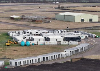 Army Barracks to House Migrants as Hotels Phase Out
 Peterborough Mosques Tighten Security After Attack
 Prunella Scales: From Fawlty Towers Icon to Beloved Canal Explorer
 UK Woman Loses Child Benefit After Booking Flight She Never Took
 UK launches search for first-ever ‘town of culture’ to highlight overlooked areas
 Dyche Criticises Corner Decision as Forest Draw with United
 Children to Learn Local History in Major Curriculum Overhaul
 Experts Warn on Home Birth Risks, Call for Skilled Midwives
 The Lowry Hotel: Manchester’s Iconic Five-Star Retreat
 Prince William Plants Trees with Brazil’s Nature Heroes
 Greta Thunberg Backs Student Facing UK Visa Revocation
 Kent village told to remove flags before Christmas lights go up
 Oprah enjoys Meghan’s jam on English muffins
 Newcastle United Lifts Ban on Fan Over Gender-Critical Views
 Jailed UK climate protesters face extremist-style restrictions
 How to get help when a child goes missing – call 999 urgently
 ‘Reckless’ cuts to victims’ services will cost more than they save
 From Lego to Pokémon: How Adults Are Driving UK Toy Market Growth
 UK Faces Arctic Blast as Polar Vortex Disruption Brings Heavy Snow
 Seven Conditions That Automatically Qualify You for a Free Bus Pass
 Mary Earps’s Manchester United Return Faces Mixed Reception
 Sam Kerr Stars in Chelsea Return with Champions League Double
 Reeves rejects £1bn plea for NHS redundancy payouts
 UK toy market enjoys bumper year as ‘kidults’ fuel demand
 Northern Lights may illuminate UK skies this week
 Politics latest: Starmer ‘will fight any leadership coup’ as Streeting denies attempt to oust Labour PM
 New weather warning issued with risk of flooding
 Former Lion Heskey Warns of Shortage of England Strikers
 UK Asylum Overhaul Sparks Debate Over Human Rights and Deportations
 Mum Calls for New Licence Rules After Teen Road Death
 Stroke Patient Mistaken for Drunk, Care Delayed
 Seven Countries, One Winner: Europe’s Best Christmas Market
 ‘Traumatic Wait’: Northern Ireland Women Face Breast Cancer Delays
 UK Vulnerable to Attack, Defence Committee Finds
 Rama Rebukes Mahmood for Targeting Albanian Families
 Serial Rapist and Former Cop Found Guilty Again
 Woman Meets Boy Whose Life She Saved with Kidney
 Raccoons Could Become America’s Next Pet
 Kate Forbes: Motherhood Harder Than Politics
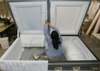 Coffins Now Too Large to Cremate Amid Rising Obesity Crisis
 Labour MP claims devolution bill is ‘blatant discrimination’ against Cornwall
 Vicki Fears Losing Motability Car
 Millions Face Higher Taxes Under Reeves New Budget
 Peers Get Extra Time to Debate Assisted Dying Bill
 Delhi’s Toxic Air Crisis Leaves Children Sick and Vulnerable
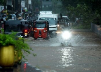 Sri Lanka Floods Leave 56 Dead, Dozens Missing
 Fibromyalgia Patients Struggle as NHS Fails to Provide Care
 Scotland Gains 33 New Towns – Life in Growing Communities
 Government righting decades-old injustice for miners
 Virgin Media Fined £23.8m Over Telecare Safety Failures
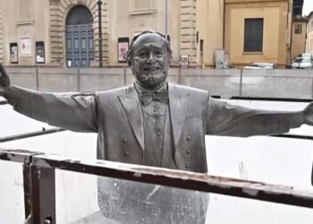 Pavarotti statue frozen in Italian ice rink sparks backlash


