

Published: 2 April 2026 . The English Chronicle Desk. The English Chronicle Online—Providing critical updates on natural disasters and regional stability.
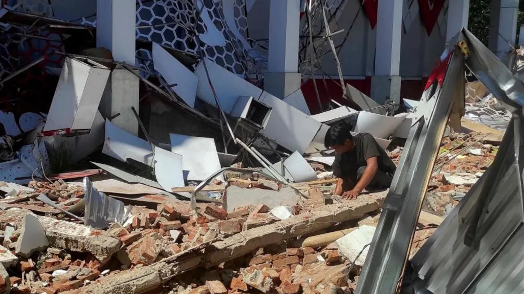
A powerful 7.4-magnitude earthquake struck off the coast of eastern Indonesia early Thursday morning, 2 April 2026, claiming at least one life and triggering a temporary tsunami warning across the region. The tremor, which originated in the Molucca Sea at a shallow depth of 35 kilometers (21.7 miles), sent panicked residents fleeing into the streets of Manado and Ternate just as the day was beginning. While the immediate threat of a major tsunami has passed, authorities remain on high alert for aftershocks and continue to assess the structural damage across the North Sulawesi and North Maluku provinces.

The sole confirmed fatality occurred in the city of Manado, North Sulawesi, where a building collapsed under the force of the shaking. Search and rescue official George Leo Mercy Randang confirmed that the victim was “buried under the rubble” and that at least one other person suffered a serious leg injury. Local news outlets, including Metro TV, broadcast footage of cracked walls and debris-strewn streets, with some residents reporting that the intensity of the quake caused items to fly off shelves and knocked out power to several neighborhoods. “I was just trying to save my family,” one street food vendor in Manado told reporters. “All that mattered was getting my children away safely.“
The earthquake triggered an immediate tsunami warning from the Pacific Tsunami Warning Center (PTWC) and Indonesia’s BMKG geological agency, covering a 1,000-kilometer radius that included parts of the Philippines and Malaysia. Within half an hour of the initial shock, elevated waves were recorded at nine locations. The highest surge, measuring 75 centimeters (2.5 feet), hit the coast of North Minahasa, while waves of 30 centimeters reached North Maluku. The warning was officially lifted approximately two hours later after sea levels began to stabilize, though officials in the historic “Spice Islands” of Ternate and Tidore urged residents to remain vigilant.
The U.S. Geological Survey (USGS) centered the quake about 127 kilometers (79 miles) west-northwest of Ternate, a city with a population of over 205,000. Because the earthquake was shallow, the energy was felt more acutely at the surface than a deeper tremor of the same magnitude would have been. National Disaster Management Agency head Abdul Muhari stated that teams are currently inspecting vital infrastructure and checking for any additional casualties in more remote coastal villages that may have been cut off by landslides or telecommunication failures.

Indonesia’s location on the “Pacific Ring of Fire”—an arc of intense seismic activity—makes it one of the most earthquake-prone nations in the world. Today’s event serves as a stark reminder of the region’s vulnerability, coming just years after devastating quakes in West Java and Sulawesi. As the sun sets over the Molucca Sea, the focus shifts to recovery and the psychological toll on a population once again reminded of the unpredictable power of the earth beneath them.
Related News:
 India and US Collaborate to Launch Groundbreaking Satellite for Earth Observation
 British AI Startup Outshines Human Forecasters in Global Prediction Contest
 History Will Remember Who Showed Up: Pressure Mounts on Keir Starmer to Attend Cop30 Summit
 UK Fighter Jet Purchase Could Breach Nuclear Treaty, Warns CND
 Google at 27: The Untold Story of Ruth Kedar, the Woman Behind the Iconic Logo
 Russia repeatedly targets UK military satellites, warns Space Command chief
 Cooper Unveils £4m Cyber Plan Against Russian Hackers
 Experts Warn Russia’s Burevestnik Missile Could Destabilise Arms Control
 Britain deploys RAF specialists to assist Belgium with drone threats
 Night after night, Belgium is on high alert.
 Hitler’s DNA Confirms He Truly Had Only One Testicle
 Pokémon to open world’s first theme park in Japan next year
 Ukraine to Get 100 French Rafale Jets in Historic Deal
 Poll Reveals China Leads World in Trusting AI Technology
 US Clears Nvidia AI Chip Sales to China in Policy Shift
 Iran Signals Permanent Break From Global Internet, Activists Warn
 UK New Car Discounts Near £6,000 as Prices Are Slashed
 Musk Wants City on the Moon Within 10 Years
 Indian University Kicked Out of AI Summit for Claiming Chinese Robot Dog as Its Own Invention
 China Shows Off Nunchuck‑Wielding Humanoid Robots for Lunar New Year
 The Chinese AI App Sending Hollywood Into a Panic
 How Do You Modernise Mango Farming? India’s Growers Urged to Innovate as Climate Change Hits
 Bill Gates Pulls Out of India’s AI Summit Over Epstein Files Controversy
 Zuckerberg Defends Meta in Landmark Social Media Addiction Trial
 Etsy Sells Second‑Hand Fashion App Depop to eBay for $1.2bn
 Musk Cuts Starlink Access for Russian Forces – Giving Ukraine an Edge at the Front
Major 7.1 Earthquake Strikes Off Malaysian Tourist Coast
Musk Cuts Starlink Access for Russian Forces – Giving Ukraine an Edge at the Front
Major 7.1 Earthquake Strikes Off Malaysian Tourist Coast
 Anthropic AI Refuses Pentagon’s Safety Demand
 Social Media Trial: Woman Says Addiction Began at Six
Instagram Investigating AI Profiles ‘Fetishising’ Disabled People
Social Media Trial: Woman Says Addiction Began at Six
Instagram Investigating AI Profiles ‘Fetishising’ Disabled People
 Anthropic Boss Rejects Pentagon Demand to Drop AI Safeguards
 Brady Tkachuk Denies AI Video Claims After Olympic Gold
 Orbital Space Race Heats Up in Arctic North
 The Sad, Strange Story of the World’s Most Radioactive Paradise
 Why Russia Controls Its People With a Flick of a Switch
 Wellness Peptide Craze: Why People Are Injecting Drugs ‘Not for Human Consumption’
 The US Now Has the Medicine for Cheap Swarming Drone Attacks
 Boy George Says He’s Using ChatGPT to Help Write New Songs
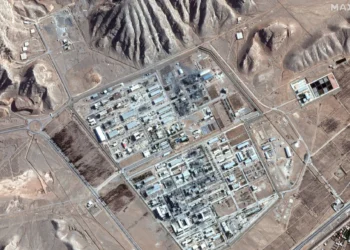
 Satellite Images Show Iranian Navy and Nuclear Sites Hit by US‑Israeli Strikes
 Protesters Rally in San Francisco Against OpenAI Deal With Pentagon
 We Have More Privacy Controls Yet Less Privacy Than Ever — The Paradox of Digital Life
 Regulator Contacts Meta Over Workers Watching Intimate AI Glasses Videos
 Study Says Only Two Nations May Survive Nuclear War
 Baba Vanga’s Chilling World War 3 Prediction and Russia’s New Leader
 Tiny Possum and Glider Thought Extinct for 6,000 Years Found in Remote West Papua
 Musk’s xAI Permit Sparks Fury Over Power Plant Expansion
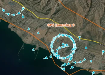 GPS Jamming: The Invisible Battle in the Middle East
 The Kill Line: A Shifting Vision of the American Dream
 Iran Social Media Strategy Shifts to Information War
 ABC Staff Strike Over Pay and AI Concerns
 Cluster Strikes Test Israel’s Missile Defences
 Zelensky Visits Saudi Arabia After Offering Drone Expertise
 One Ant for $220: The New Frontier of Wildlife Trafficking
 How and When to See April’s Full Pink Moon
 How Iran Destroyed US Base’s $500m Battlefield Nerve Centre
 Trump Considers Military Operation to Seize Iran’s Uranium
 Jim Ratcliffe’s £3.5bn Chemical Plant Delayed with Parts Stranded in the Gulf
 Trump Building ‘Massive’ Military Bunker Under White House Ballroom
 The Death-Defying Nuclear Commando Mission That Could End the War
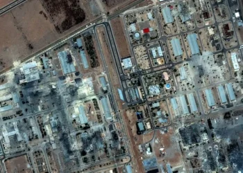
 Baltic Blackout: Satellite Images Reveal Scorched Russian Oil Hubs After Ukraine Strikes
 ‘Excitement’ at Salisbury Plain as UK Conducts Largest Military Parachute Drop in a Decade
 The ‘Simpler Recycling’ Era: England’s New Bin Rules Face a Patchy Rollout
 ‘A Million Things’: The Unprecedented Peril of Seizing Iran’s Uranium Stockpile
 ‘The Counting of a Nation’: India Launches World’s Largest Census Amid Tech Revolution
 ‘At the Doorstep of the Future’: Florida’s Space Coast Braces for Historic Artemis II Launch
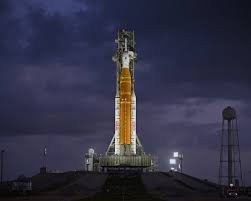 Artemis II: Humanity Returns to the Moon After Decades
 ‘We Go for All Humanity’ — Artemis II Returns Humans to the Lunar Vicinity
 The Orion Capsule: A High-Stakes Vigil in Earth’s Orbit
 Beyond the Atmosphere: A Comprehensive Guide to Artemis II
 A Name for the Nameless: DNA Finally Links 1974 Utah Murder to Ted Bundy
 UK Must Act with Courage and Clarity on Israel-Palestine Conflict, Says Foreign Affairs Committee Report
 ‘Extinct’ Antelope Returns to Sahara, Bringing Hope
 Sydney Shark Attack Surge Shocks Australia Beaches
 AI breast screening cuts later cancer diagnoses by 12%, study finds
 Most Statin Side-Effects Are Not Caused by Drugs, Study Confirms
 Portugal Election Delivers Socialist Win as Far Right Surges
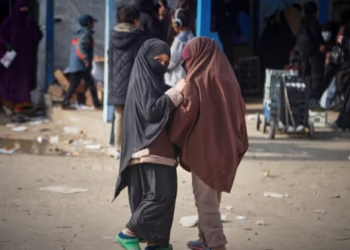 Australian Families Leave Syrian Camp for Home
 ‘I Would Scream in My Sleep’: Alawite Women from Syria Tell of Kidnap and Rape
 Councils Pressed to Use Universal Parking App to Cut ‘Unfair’ Fines
 ‘The Insulation Trap’: Knifeman Discovered Hiding Under Loft Padding After Six-Hour Standoff


