
Published: 14 August 2026 | The English Chronicle Desk | The English Chronicle Online
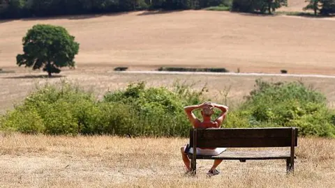
The UK’s latest heatwave is expected to reach its final widespread day on Friday, with temperatures forecast to climb as high as 34C (93F) in parts of south-east England before a much cooler weekend brings relief across the country.
The latest spell of extreme heat has already produced some of the highest temperatures recorded in the UK this year. Thursday was the hottest day of 2026 so far, with Kew Gardens in London reaching 38.1C. The temperature also placed Thursday among the five hottest days ever recorded in the UK.
For many people, Friday will therefore represent a final opportunity for very high temperatures before fresher air spreads across the country. However, health authorities continue to warn that the effects of the heat will remain significant, particularly for vulnerable people and health and social care services.
Amber heat-health alerts issued by the UK Health Security Agency remain in place across England until 21:00 BST on Friday. The warnings underline the potential consequences of prolonged exposure to high temperatures, particularly for older people, those with existing health conditions and people who may struggle to stay cool.
The contrast between regions will be particularly noticeable on Friday. While the south-east and parts of central England remain hot, northern and western areas will begin to experience a significant reduction in temperatures.

In the Midlands, Lincolnshire, East Anglia and south-east England, long periods of sunshine are expected to push temperatures towards 29-34C. Some locations could therefore experience another day above official heatwave thresholds.
The south-east will be the main focus of the heat, while temperatures elsewhere will generally fall into the low or mid-20s. Although those values remain above the typical August range in some areas, they will feel considerably more comfortable compared with the exceptional conditions experienced earlier in the week.
The change is being driven by cooler air moving in from the north and west. Cloudier conditions and occasional showers will accompany the transition, with some areas potentially seeing heavy or thundery downpours.
The arrival of cooler air will bring an abrupt end to what has been an unusually intense period of summer weather.
Thursday’s temperature of 38.1C at Kew Gardens was particularly significant. It was the highest temperature recorded in Britain during 2026 and the fifth-highest temperature ever recorded in the country.
The UK also reached 38C earlier this summer, when Lingwood in Norfolk recorded 38.0C on 26 June. This means temperatures have reached at least 38C twice during the same year.
That has happened only once before. The previous year in which Britain recorded two separate occasions of temperatures reaching 38C was 2022.
The latest heatwave is therefore part of a wider pattern of unusually intense heat affecting the UK this year.
The frequency of extreme temperatures is also placing greater attention on the health consequences of heatwaves. Unlike cold weather, which can often be associated with obvious seasonal risks, extreme heat can affect the body quickly, particularly when high temperatures persist overnight and prevent people from recovering during sleep.
The UK Health Security Agency’s amber alerts reflect concerns that prolonged heat can increase pressure on health services and contribute to illness among vulnerable groups.
For most of England, however, the immediate concern should begin to ease from Saturday.
Saturday will remain warm in south-eastern England, but temperatures are expected to fall below the threshold generally associated with heatwave conditions. By Sunday, fresher air should have reached all parts of the UK.
Temperatures are expected to settle broadly between 17C and 26C, much closer to normal levels for August.
The weekend is also expected to remain largely dry for much of the country, despite the changing temperatures.
That lack of rainfall presents a separate problem.
Southern England has experienced an exceptionally long period without significant rain. Some parts of the region have now gone for almost two months without notable rainfall, raising increasing concerns about water supplies, agriculture and the wider effects of drought.
Wisley in Surrey could reach approximately 60 consecutive days without rain by Sunday if the current pattern continues.
The end of the heatwave therefore does not necessarily mean the end of the UK’s water problems.
Lower temperatures will reduce evaporation and make conditions more manageable, but they will not immediately reverse the accumulated rainfall deficit. Rivers, reservoirs, soils and agricultural land require sustained rainfall over time before drought conditions can significantly improve.
The weather outlook for next week offers some possibility of change.
An area of low pressure is expected to move closer to the north-west of the UK, bringing rain-bearing weather fronts into parts of the country.
Scotland and Northern Ireland are likely to receive much of the rainfall on Monday. By Tuesday, showers could spread into northern England and north Wales, with some of those potentially moving farther south.
That could provide welcome rainfall in some areas, but there is considerable uncertainty over how much rain southern England will actually receive.
Some areas already experiencing drought could remain relatively dry even as wetter weather affects other parts of Britain.
This uneven distribution is important because rainfall totals can vary significantly over relatively short distances. A few heavy showers may produce substantial rainfall locally while leaving nearby areas with little or nothing.
The transition from extreme heat to cooler conditions will also create a different set of weather-related challenges.
Heavy and thundery showers can develop along boundaries between hot and cooler air. Although they may temporarily provide relief from the heat, they can also produce intense rainfall, gusty winds and localised disruption.
For communities that have experienced prolonged dry conditions, sudden heavy rainfall may not necessarily translate into an immediate improvement in water availability. Dry ground can struggle to absorb intense rainfall efficiently, particularly when precipitation falls in short, concentrated bursts.
The latest heatwave has also highlighted how quickly British weather can move between extremes.
The country entered the summer with repeated periods of high temperatures, and the latest spell has produced exceptional readings in London and eastern England. Within days, the same regions are expected to experience much cooler conditions.
For households, the immediate change will be welcome. People who have struggled with overheating homes, disrupted sleep and difficult working conditions will be able to return to more manageable temperatures.
For farmers and water managers, however, the end of extreme heat will offer only limited relief unless it is followed by meaningful rainfall.
The agricultural sector has already faced significant pressure from dry conditions. Crops require adequate soil moisture throughout the growing season, while livestock and horticultural producers depend on reliable water supplies.
The contrast between the appearance of a cooler weekend and the underlying drought situation illustrates why temperature alone cannot tell the whole story about Britain’s weather conditions.
A cooler forecast may reduce immediate health risks, but it does not automatically resolve the longer-term environmental consequences of prolonged heat and rainfall shortages.
Friday will therefore mark a turning point rather than a complete return to normality.
The most intense temperatures should be confined mainly to south-east England, while northern and western parts of the country experience a noticeable cooling trend. By Sunday, temperatures should be much closer to seasonal averages.

The next challenge will be determining whether the approaching low-pressure system can finally deliver meaningful rain to the parts of England that need it most.
For now, the message is relatively straightforward: the worst of the heat is expected to pass, but the consequences of the UK’s exceptionally hot and dry summer are likely to remain.
As temperatures fall over the weekend, attention will increasingly turn from heat-health warnings to the country’s continuing drought, water shortages and the prospect of whether August can deliver enough rain to begin repairing the damage caused by weeks of extreme weather.
Related News:
 UK Winter Nowhere Near a Record Breaker Despite Floods and Storms
 UK Records Warmest Day of the Year as Temperatures Exceed 18 °C
 Family Says Heatwave Drownings Reopen Grief
 UK Braces for Prolonged Heatwave as Amber Alerts Issued
 Hospital Urges Public Never to Leave Dogs in Hot Cars
 UK Schools Struggle as Classrooms Top 40C
 London Tube Heat Reaches Dangerous Levels
 UK Heatwaves May Have Claimed Thousands of Lives
 UK Heatwave Nears Two-Week Milestone as High Temperatures Continue Across the Country
 Fourth Heatwave Brings 35C Temperatures to UK
 Amber Heat Health Alerts Issued as UK Heatwave Set to Reach 35C Peak
 Heatwave-Linked Excess Deaths in England Nearly Double Compared with Last Year, New Analysis Suggests
 Calls Grow to Ban Toxic Pet Flea Treatments
 Dozens of Flood Warnings in England After Days of Non-Stop Rain
 UP IN FLAMES: Huge Blaze Rips Through Odeon Cinema, Students Evacuated
 Snow and Rain Warnings as Cold Snap Continues in the UK
 Flooding May Worsen Before It Improves as More Rain Forecast for the UK
 Illegal Skin Lightening Cream Being Sold in UK Butchers, Watchdog Warns
 Break from Wintry Weather as UK Temperatures to Climb to 14 °C
 Spring‑Like Warmth to Peak on Wednesday with 18 °C Forecast
 ‘I Almost Died After a Touch‑and‑Go C‑Section’
 Conservation Budgets Hit by Increased Fly‑Tipping Costs
 Water Cremation Introduced in UK First
 Scots Firefighter Cycles 800 Miles for MND Charity
 Woman, 29, ‘Chucked’ Into Care Home 100 Miles Away
 Community farm appeal to cover thousands in repairs
 Father Dies by Suicide Weeks After Wedding in Clitheroe
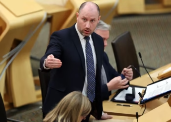 SNP Health Secretary Criticised Over NHS Failures Locally
 Scotland Combines Alcohol and Drug Strategy to Cut Addiction Deaths
 Dad Delivers Baby After Midwife Flees During High‑Risk Labour in UK
 Schnauzer Travels 140 Miles for Life-Saving Spinal Surgery
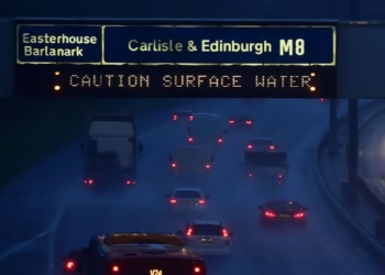 Travel Chaos on M8 and M74 Amid 70 mph Gales as Trains Also Cancelled
 ‘A Living Nightmare’: Parents of Vaccinated Teenager Speak Out After Rare Meningitis B Battle
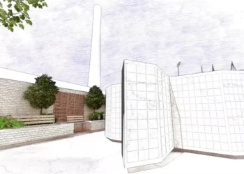 The High Cost of Survival: How the 2026 Fiscal Outlook is Redefining British Life
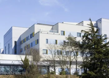 Safety Fears at New £200m Maternity Unit: Mums-to-Be ‘Put at Risk’
 Spring Awakening: Temperatures to Hit 17°C as Britain Bathes in Sunshine
 Fuel Famine: How African Nations are Rationing Power and ‘Diluting’ Petrol to Survive
 ‘My Daughter is Under the Rubble’: The Human Cost of the Tehran Strikes
 Parents Warned Against Letting Children Cuddle Lambs Following Infection Spike
 Storm Dave Disrupts Travel but Conditions Set to Ease
 ‘Look After the Children’: The 84-Year-Old Widower Fighting a Broken Care System
 ‘The Best Decision I Ever Made’: A Mother’s Viral Plea After a Near-Miss with Lung Disease
 The Miracle of Phoenix: ‘Half Dead’ Rescue Dog Defies the Odds in Worcestershire
 The Hidden Hurdle: Breaking the Silence on Athletic Incontinence
 The Friendship Friction: Would You Call Out Your Friend’s Toxic Behaviour?
 Near-Miss Tragedy: 11-Year-Old Injured After Found Gun Discharges
 The Price of Help: Fuel Surge Threatens Charitable ‘Power Plant’
 Heroism on the Platform: Strangers Save Youth After Seizure on Train Tracks
 Toxic Trail: Dog Owners Warned Over ‘Vile’ Poisoned Meat Found in Parks
 The Wheels of Hope: Charity Delivers ‘Seismic’ Joy Through Specialized Bikes for Children with Cancer
 The Waiting Ward: ‘Month of Worry’ as Doctor Strikes Trigger Seismic Surgery Delays
 Rights and Respect: Nurse Wins Legal Settlement Over Transgender Pronoun Dispute
 ‘A Walking Miracle’: UK’s Youngest In-Utero Transfusion Patient Celebrates Recovery
 NHS Safety Fears as Nurses Cover Doctor Gaps
 A Nation in Flux: UK Healthy Life Expectancy Plummets to Record Lows
 The “Cancer Commute”: Patient Warns of Breaking Point Over 40-Mile Treatment Trek
 “Adult Trends” for Children: Mum’s Viral Horror at “Sexualised” Swimwear in Major UK Retailer
 Robotic Revolution: UK Surgeons Complete First “Fully Autonomous” Abdominal Procedure
 “Invisible Agony”: 98-Year-Old Woman Left in “Severe Pain” for Days Amidst Care Backlog
 The “Time Tax” of Memory: Why Dementia Care is the Ultimate Test of UK Resilience
 “Fear is a Choice”: The 80-Year-Old Great-Grandmother Defying the “Dopamine Desert”
 The “Dementia Deficit”: Why 2026 is the Breaking Point for UK Social Care
 Precision Without the Scalpel: UK Team Reaches “New Frontier” in Robotic Abdominal Surgery
 Tractor Breakdown Tests Lincolnshire Farmers
 Britons Build Emergency Supplies Amid Rising Fears
 Sycamore Gap Artwork Chosen After Public Vote
 Pope Meets Families in Italy Toxic Waste Zone
 Emergency Caesareans Rise Across England
 Woman Warns of Lifelong Damage From Ketamine
 Deadly Earthquake Hits Philippines
 Signs of Recovery Emerging for Young People
 Harriet Sperling: The NHS Nurse Drawn Into the Royal Spotlight
 Temperatures Set to Fall This Week, But Forecasters Warn Heat Could Return Soon
 Parents Fundraise to Cool Overheated School Classrooms
 Three-Quarters of England’s Riverbanks Still Off Limits
 French Firefighters Battle ‘David vs Goliath’ Wildfire
 Storms Set to End UK Heatwave with Flood Warnings
 Walk-In Mental Health Hubs Planned Across England
 NHS Trust Adds Doctors to Speed Up Cancer Review
 Heatwave Leaves UK Veg Looking Wonkier Than Ever