
Published: 30 December 2025. The English Chronicle Desk. The English Chronicle Online.
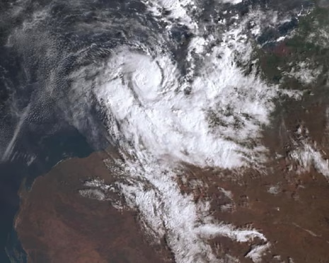
Australia faces dual weather crises as Tropical Cyclone Hayley barrels toward the north-west coast, while northern Queensland mourns a man’s death in severe flooding. Authorities reported the tragic passing of a man in his seventies after police discovered his vehicle submerged near Normanton around 3pm on Tuesday, highlighting the persistent dangers of extreme weather across the country. As the nation grapples with these twin threats, residents in remote western communities brace for the cyclone’s destructive impact.
Tropical Cyclone Hayley, classified as a category three system, is forecast to make landfall near Derby on Tuesday night, prompting urgent warnings for residents in Beagle Bay, Cockatoo Island, and Derby that evacuation may no longer be possible. Following the recent passage of Tropical Cyclone Fina over Darwin in November, Hayley represents a continuing challenge to northern Australia, where communities face escalating risks during the cyclone season. Local officials emphasised that those residing in caravans or older housing structures should immediately relocate to designated evacuation centres or other secure locations.
Meteorologists warn that Hayley could produce winds reaching 170 km/h across the northern Dampier Peninsula, alongside heavy rainfall capable of triggering flash flooding. The Bureau of Meteorology highlighted that similar conditions in 2023, caused by ex-Tropical Cyclone Ellie, led to catastrophic flooding that isolated towns such as Derby for weeks, showing how vulnerable the region remains to extreme rainfall events. With only a single road linking Derby to the broader region, disruptions from wind or flood damage could severely hamper essential supply deliveries.

Local business owner Tameka Plummer, managing a bakery and bottle shop at Derby’s IGA supermarket, detailed preparations to secure essentials including water, torches, and power banks. She noted that trucks had already transported excess stock to reduce potential losses, warning that barge deliveries to the port would be prohibitively costly if road access were cut off. Similarly, Peter McCumstie, president of Derby/West Kimberley Shire, acknowledged the destructive potential of Hayley but expressed confidence in long-standing preparation practices, including tree trimming and drainage clearance, which help mitigate damage during cyclone events.
Hayley’s trajectory has it positioned roughly 185 km north-west of Broome, moving eastward toward Cape Leveque. Jonathan How from the Bureau of Meteorology noted that unusually warm seas contributed to the cyclone intensifying rapidly, with winds near the centre already reaching 140 km/h and gusts hitting 195 km/h on Tuesday morning. Authorities anticipate destructive gales above 150 km/h at landfall, with localized areas potentially experiencing very destructive winds up to 170 km/h. Such conditions threaten to down trees and power lines, while flash flooding may render outback roads impassable.
The official warning zone spans from north of Broome to Kuri Bay, covering Derby, Beagle Bay, and the entirety of the Dampier Peninsula. Residents are urged to shelter indoors immediately, according to WA’s Department of Fire and Emergency Services Assistant Commissioner Stuart Wade, emphasizing that it is now too late to evacuate safely. Evacuation centres, such as the Broome Recreation and Aquatic Centre, remain open for those requiring refuge.
Derby is particularly susceptible due to its location at the base of King Sound, an area renowned for enormous tides reaching up to 12 metres. With Tuesday’s high tide coinciding with the cyclone’s landfall, forecasters warn of amplified waves and coastal hazards. Despite the looming threat, locals like Plummer remain cautiously hopeful that the rain will replenish much-needed water reserves, provided it does not cause flooding.
On the national stage, Prime Minister Anthony Albanese expressed solidarity with affected communities, underscoring the ongoing challenges posed by the tropical cyclone season, which spans from November to April. Historical patterns show that Australia typically experiences two or three category-four cyclones annually. Climate change projections suggest future cyclones may occur less frequently but could increase in intensity, heightening risks for vulnerable regions. The recent November impact of Tropical Cyclone Fina marked the earliest cyclone to cross the Northern Territory coastline, reinforcing concerns about changing weather patterns.

Meanwhile, northern Queensland contends with the aftermath of a slow-moving monsoon trough that has delivered persistent heavy rainfall, reaching 200 mm per day in some areas. South Mission Beach recorded 796 mm over 72 hours, prompting ongoing emergency preparations. Queensland Premier David Crisafulli confirmed that emergency services and fuel reserves have been pre-positioned, though the full scope of the flood impact remains uncertain. The tragic death of the Normanton resident illustrates the dangers of rapidly rising floodwaters in remote northern communities.
Authorities stress that coordination between meteorological agencies, emergency services, and local councils is critical in managing dual weather threats. Residents are encouraged to remain informed, maintain emergency supplies, and follow official guidance closely to reduce the risk of harm. The situation underscores the increasing vulnerability of remote and coastal communities to extreme weather events, highlighting the need for continued investment in resilience and preparedness measures.
As Tropical Cyclone Hayley approaches and Queensland faces severe flooding, Australia is reminded of the growing intensity and unpredictability of weather systems. The combination of strong cyclones, heavy rainfall, and limited infrastructure in remote areas creates complex challenges for emergency management. Communities across northern Australia are bracing for the impacts while relying on long-standing preparation practices, resilience, and timely government support to navigate these dangerous conditions.
Related News:
 UK Banks Granted Reprieve as BoE Delays Basel III Capital Rules Until 2028
 Singapore Corruption Scandal: Details Emerge on Iswaran’s Luxury Flight and Ties to Tycoon Ong Beng Seng
 Corfu Beyond the Crowds: Discovering Serenity in Southern Villages and Hidden Taverns
 Peter Andre Praises Son Junior’s ‘Quiet Season’ Amid Ongoing Family Dispute
 Massive 641-Mile Storm Set to Batter UK with 15 Hours of Rain and Strong Winds
 Jeremy Clarkson’s Pub: A Sunday Lunch Like No Other
 Scottish Government Mandates Single-Sex Toilets and Changing Facilities in Schools
 Reeves Faces Setback as Labour May Miss Homes Target
 Kate Winslet to Narrate Film Highlighting King’s Environmental Mission
 Trump’s UK Ambassador Urges North Sea Drilling to Strengthen US Ties
 UK Bans Fake Numbers: Scammers Lose Their Trick
 Liberal Turmoil Threatens Victorian Election Hopes
 British skier killed in La Plagne avalanche tragedy
 Xabi Alonso leaves Real Madrid, Arbeloa Takes Over
 Trump Policies Boost China’s Global Rise, Survey Finds
 Markets Slide As Gold Rally Signals Risk From Trump Greenland Tariff Plan
 UK Inflation Hits 3.4% in December, Ending Five-Month Decline
 Silence and Unity Mark Bondi Terror Attack Memorial
 Huge mistake: Labour blocks Burnham from byelection bid
 India-EU Free Trade Deal Marks Historic Economic Shift
 Labour targets Greens on drugs in Gorton Denton byelection
 Greens nominate Hannah Spencer for Gorton and Denton byelection
 John Lithgow criticises Rowling stance in trans debate
 Autistic Girls Often Missed in Childhood Diagnoses, Study Finds
 Labour Thinktank Row Deepens Over Journalist Probe Claims
 Telstra AI jobs cuts as automation drive expands
 Cabinet Secretary Shake-Up Triggers Due Diligence Warning
 Starmer Faces Inquiry Calls Over Thinktank Probe
 UK shelves £110m border project amid trade strain
 Arsenal blow lead as Arteta rues Wolves draw
 California Democrats Vow Trump Reckoning
 British Dual Nationals Face Travel Block From UK, Home Office Confirms
 Trump’s Surgeon General Pick Evades Vaccine Questions
 Facial Recognition Error Leads to Wrongful Arrest in Milton Keynes
 The Dangerous Rise of Remigration Across Modern Europe
 Green Party Stuns Labour in Gorton and Denton Byelection
 Labour Together scandal sparks clean break vow
 Grocery Inflation Rises Amid War Fears
 Zorevunersen Breakthrough for Dravet Syndrome
 BrewDog sold Highland estate for knockdown price after abandoning reforestation plans
 Taking Multivitamins Daily Could Slightly Slow Ageing, Study Finds
 US Missile Strike on Iran School Sparks Global Shock
 Champions League Failure Sparking Premier League Crisis
 NHS Plans to Cut Overseas Workers Labeled Overambitious
 Utah Woman Found Guilty of Poisoning Husband for Inheritance
 Oil Slides, Stocks Jump on Trump Peace Signals
 African World Cup Fans Face $15,000 Entry Bond Fee
 Middle East Deluge: Freak Storms Bangle Desert Nations
 Farage Shuns Truss as US Right-Wing Roadshow Hits London
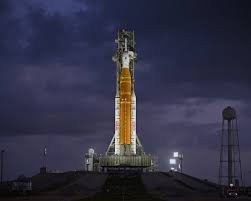 Artemis II: Humanity Returns to the Moon After Decades
 Italian Town Buys Mussolini Villa to Keep Away Fascist Fans
 The Price of Hubris: Trump, Netanyahu, and the ‘Easy’ War
 Trump and Tehran Find Common Ground in Landmark Ceasefire
 National Energy Grant Proposed to Slash UK Household Bills
 Stefano Gabbana Resigns as Chair of Italian Luxury Giant
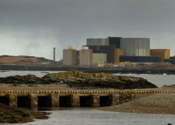 Rolls-Royce SMR Secures £600m Boost for Nuclear Future
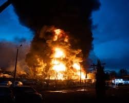 Kyiv and Odesa Mourn After Deadly Wave of Russian Strikes
 Medellín’s Green Revolution: A Global Climate Blueprint
 Robots Outpace Humans in Beijing Half-Marathon
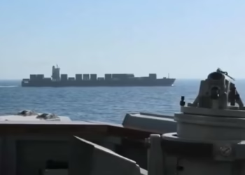 US Forces Seize Iranian Ship Near Hormuz Blockade
 Japan’s Youth Defend Pacifist Constitution
 Investigation: Offshore Loans and Sanctions
 Trump Defiant After Washington Hotel Shooting
 Cross-Border Crisis Shatters Fragile Afghan Peace
 Urban Flood Crisis: A Growing Threat to English Homes
 The Fear Gap: Why Europe Feels Less Safe Than It Is
 US Military Pacific Boat Strike Kills Three People
 Dettol Apologises for ‘Toxic Men’ Advert Backlash in China
 UK Care Crisis: Row Explodes Over New Visa Settlement Rules
 Sainsbury’s Boss Optimistic As Grocery Inflation Eases
 US Advance Past Bosnia in World Cup Thriller
 Trump’s Mount Rushmore Speech: A Divisive Anniversary
 Trump’s Red-Card Intervention Hurts the US World Cup
 US Airman Avoids British Court in Indecent Exposure Case
 Britain’s Mini Fan Craze Sparks Major Waste Crisis
 Trump Swaps Planes Amid Iran Tensions
 Ann Widdecombe, Formidable Political Figure, Dies at 78
 UK Schools Struggle as Classrooms Top 40C
 Yemen Accuses Iran of Violating National Sovereignty
 Houthis Strike Saudi Arabia as Middle East Tensions Rise