
Published: 28 September 2026. The English Chronicle Desk. The English Chronicle Online
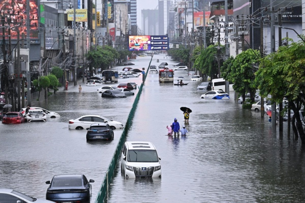
Bangkok has been declared a disaster zone after days of relentless rainfall left parts of Thailand’s capital submerged under waist-high flood water, while the weather system responsible for the extreme conditions has shifted north-westwards, bringing some relief to the city but continuing to affect other parts of the country.
The flooding developed after an area of low pressure became established across central Thailand, generating persistent heavy rain and thunderstorms over Bangkok and surrounding provinces. The system remained almost stationary for much of Friday and Saturday, allowing rainfall to accumulate rapidly across already saturated areas.
The downpours began early on Thursday as the weak low-pressure system moved north-westwards across the Gulf of Thailand. By Friday morning, it had reached central Thailand and settled over the region. Instead of moving away quickly, the system remained broadly in place for nearly two days, producing repeated periods of intense rainfall.
The prolonged nature of the rainfall was a major factor behind the flooding. When a weather system remains over the same area for an extended period, rain can continue falling faster than drainage systems, rivers and waterways can accommodate it. In heavily developed urban areas such as Bangkok, where large amounts of land are covered by roads, buildings and other infrastructure, excess water can accumulate particularly quickly.

Several areas experienced severe flooding, with some streets in Bangkok reportedly covered by water reaching waist height. Residents in affected neighbourhoods faced difficult conditions as flood water entered homes, disrupted transport and made ordinary journeys increasingly hazardous.
The scale of the rainfall was also evident from measurements outside the capital. A weather station near Prachin Buri, north-east of Bangkok, recorded 213.5mm of rain during a 24-hour period between Friday and Saturday evening local time. Such totals illustrate the intensity of the weather system and the amount of water that fell across central Thailand within a relatively short period.
By Sunday, however, there were signs of improvement in Bangkok as the low-pressure centre began moving north-westwards. The shift brought an end to the most torrential rainfall over the capital and reduced the immediate pressure from continuous downpours.
The change in weather does not mean that the effects of the flooding disappear immediately. Even after rainfall decreases, flood water can remain in low-lying areas for hours or longer, while roads, drainage networks and public services may require additional time to return to normal.
The flooding also highlights the vulnerability of major cities to prolonged periods of extreme rainfall. Bangkok is situated in a low-lying region and has extensive networks of roads, buildings, canals and drainage infrastructure. Heavy rainfall can therefore create complicated challenges, particularly when large volumes of water arrive over consecutive days.
While attention has been focused on Thailand, significant weather threats have also developed elsewhere in the Pacific.
Hurricane Nolo posed a serious threat to Hawaii’s Big Island over the weekend after approaching the Hawaiian archipelago from the east. The storm began producing heavy rainfall around Tuesday evening last week before strengthening as it moved through the central Pacific.
By the early hours of Saturday, Nolo had reached Category 2 hurricane strength, with sustained winds estimated at between 85 and 90 knots, equivalent to approximately 98 to 104mph.
The hurricane passed closest to the Hawaiian archipelago at a distance of roughly 145 miles, or 233km, south of the Big Island. Although the storm’s centre did not make a direct landfall on the island, its large circulation brought substantial amounts of rain and raised concerns about flooding and mudslides.
The rainfall totals associated with Nolo were particularly significant in the north-eastern part of the Big Island. Since the storm’s effects began late on Tuesday 22 September, some weather stations in the region had recorded more than 530mm of rainfall.
Such rainfall can create serious hazards even when a hurricane’s strongest winds remain offshore. Mountainous terrain can increase the risk of rapid runoff, while saturated ground can become unstable and vulnerable to landslides. Rivers and streams can also rise quickly when intense rainfall continues for several days.
Nolo has since moved westwards away from Hawaii, reducing the immediate threat to the islands. Forecasts indicated that the hurricane could reach its maximum intensity on Monday, potentially strengthening to Category 4 status.
The contrasting weather situations in Thailand and Hawaii demonstrate how tropical and subtropical weather systems can create major hazards across widely separated regions at the same time. In both cases, rainfall has been a central concern, with flooding and landslides posing risks even when the strongest winds are not directly affecting populated areas.
Another major storm was also developing farther east in the Pacific.
Hurricane Polo was forecast to approach the Baja California peninsula late on Monday, with the storm expected to weaken considerably before reaching land. Having previously reached Category 5 intensity, Polo was forecast to decline to approximately Category 2 strength by the time it reached the peninsula.
Despite the expected reduction in wind intensity, the storm remained potentially dangerous because of the combination of strong winds, heavy rainfall and coastal flooding risks.
A hurricane warning had been issued for parts of the coastal region because of the possibility of storm surge, particularly in locations where winds push seawater towards the shore. Storm surge can become one of the most dangerous aspects of a hurricane, especially when combined with heavy rainfall and high waves.
Polo was also expected to produce intense rainfall while crossing the peninsula. Forecast estimates indicated widespread totals of between 100mm and 200mm, with locally higher amounts potentially reaching 250mm.
The timing of that rainfall was an additional concern. Much of the precipitation was expected to fall within approximately 12 hours, increasing the possibility of rapid flooding and mudslides.
After crossing the peninsula, Polo was expected to continue weakening while moving north-eastwards across the Sonora region of Mexico. Even as a tropical cyclone loses strength, however, its remaining moisture can still produce dangerous rainfall, particularly over mountainous or poorly drained areas.
The succession of weather threats has placed renewed attention on the importance of preparedness, early warnings and reliable weather information. Severe rainfall does not always coincide with the strongest part of a storm, and communities can remain vulnerable after the centre of a weather system has moved away.
For Bangkok, the immediate priority is now dealing with the consequences of the flooding while monitoring the movement of the weather system farther north-west. The reduction in rainfall offers some relief, but residents in flooded areas still face the difficult process of removing water, protecting property and restoring disrupted daily life.
For communities on Hawaii’s Big Island, the focus has shifted towards the continuing effects of rainfall and the potential for landslides and flooding as saturated ground responds to the accumulated water.
Meanwhile, residents along the Baja California peninsula are preparing for another tropical threat as Polo approaches.

The three weather systems have followed different paths and produced different levels of impact, but they share a common feature: the ability of heavy rainfall to disrupt communities rapidly. From flooded streets in one of Asia’s largest cities to rain-soaked mountainous areas in the Pacific, the consequences of extreme weather often extend well beyond the immediate passage of a storm.
As Bangkok begins to recover from several days of exceptional rainfall, attention will remain on whether drainage systems can clear accumulated water and whether further rain develops across affected regions. Elsewhere, authorities and residents will continue monitoring Nolo and Polo as the storms move through the Pacific.
The latest events serve as another reminder that extreme rainfall can become a major humanitarian and infrastructure challenge even when the most intense winds remain offshore. For people living in vulnerable areas, the difference between a dangerous storm and a devastating disaster can depend on rainfall duration, ground conditions, drainage capacity and the speed with which communities can respond.
Related News:
 Nepal seeks $20m climate compensation after deadly floods
 Nepal PM calls deadly flood a global climate warning
 Wildfires rage across Europe as hundreds arrested in France
 Nepal Rescuers Race to Save Hundreds Trapped Underground
 UN Warns Record El Niño Could Supercharge Global Heat
 Japan Braces for Dujuan as Storm Threat Grows
 Typhoon Dujuan Leaves Four Dead in Japan
 Super El Niño Threatens Hundreds of Thousands of Lives
 Evacuations Ordered as California Wildfires Spread Fast
 Queensland Braces for Potential Second Severe Cyclone Hit
 Cyclone Vaianu Forces Mass Evacuations in New Zealand
 Escobar’s Hippos May Be Moved to India Zoo
 Capitalism ‘Suicidal’, Warns Petro at Climate Summit
 Venezuela Quake Death Toll Surpasses 4,000
 Powerful 7.7-Magnitude Earthquake Hits Eastern Indonesia
 Heavy Casualties Feared as Flash Flood Sweeps Nepal-Tibet Border
 Australia Races to Find Tourists Missing in Nepal
 Nepal Flood Death Toll Tops 300 as Second Flood Feared
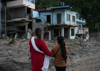 Nepal-Tibet Flood Death Toll Rises as 2,478 Remain Missing
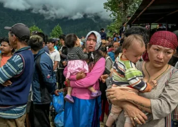 Nepal Flood Survivors Face Unimaginable Loss
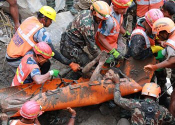 Nepal Tunnel Rescue Offers Hope Amid Flood Devastation
 Typhoon Saudel Triggers Mass Evacuations in China

 Europe Faces Climate Reckoning After Extreme Summer
 ‘Extinct’ Antelope Returns to Sahara, Bringing Hope
 Japan Prepares for Kashiwazaki Restart After Fukushima Legacy
 Half the World’s Largest Cities Face Rising Water Stress
 The Sound of Mayhem’: Terror and Loss at Mount Maunganui
 Reindeer Deaths Rise as Finnish Herders Blame Border Wolves
 Storm Leonardo Triggers Election Delay Calls in Iberia
 Ocean Warming Drives Massive Marine Life Loss, Study Warns
 Greenpeace $345m Ruling Sparks Appeal Battle
 Musk’s xAI Permit Sparks Fury Over Power Plant Expansion
 The Truth Behind Rising Energy Costs and Fossil Fuel Myths
 North Korea Fires Missiles Amid US-South Korea Drills
 Extreme Weather: Europe Shivers as Cyclone Narelle Hits
 Trump to Deploy “God Squad” Over Gulf Wildlife Protections
 Southeast Asia Turns to Russia Amid Energy Crisis
 Coalition pushes fossil fuel phaseout plan
 Ukraine strikes Tuapse as oil disaster worsens
 China Fireworks Factory Blast Kills 21 in Hunan
 Australia pushes Pacific security pact amid China tension
 Norway Doubles Down on Oil and Gas for Europe Energy Security
 US Awaits Iran Reply on New Ceasefire Proposal
 UN Faces Crucial Vote on Landmark ICJ Climate Ruling
 UK Faces Mass Water Shortages by 2055, Lords Warn
 Hormuz Talks Near Critical Stage
 Maldives Cave Diving Tragedy Raises Safety Alarm
 Pope Meets Families in Italy Toxic Waste Zone
 Discontent grows around Putin amid war strain
 Man killed in shark attack on Great Barrier Reef
 Hope for mountain bongos returns to Kenya
 Germany Summons Chinese Envoy Over Russian Troop Training
 Sydney Records Hottest June Since 1859 as Expert Warns New High a ‘Signature’ of Global Warming
 Millions Gather for Khamenei’s Six-Day State Funeral
 UK Heatwaves Ignite Crisis of Sleep and Public Safety
 Olympus Awaits Unesco Heritage Recognition
 Houthis Strike Saudi Arabia as Middle East Tensions Rise
 Wildfires Force Mass Evacuations in France And Spain
 Three-Quarters of England’s Riverbanks Still Off Limits
 Israeli Strike in Southern Lebanon Kills Seven
 Families Fly to Nepal in Search of 33 Missing Britons
 Nepal Flood Death Toll Tops 1,000 as Tunnel Search Intensifies
 Daughter Finds Bones in Parents’ Burned-Out Car
 Swedish Mining Push Puts Sami Land Rights Under Pressure
 Saudi Arabia Shuts Oil Pipeline After Drone Attack
 Nearly 50,000 Flee as Houthis Advance in Yemen
 Indonesia Receives First Aircraft Carrier
 Saudi Pact Raises Risk of Pakistan Entering War
 Middle powers seek new alliances amid Trump era
 Tropics May Wait Longest for Net-Zero Climate Benefits
 Japan PM Backs International Criminal Court
 AI Takes Centre Stage in Trump-Xi Talks
 Iran Rejects Claims of Shift in US Talks
 Trump gives Xi red-carpet welcome as trade truce extends
 Chinese Hybrid Car Surge Raises EU Auto Industry Concerns
 Greece Pushes for Parthenon Marbles Reunification
 Ukraine and Russia Escalate Long-Range Drone War
 Xi urges Trump to avoid US-China military conflict
 Saudi intercepts Houthi missiles as oil fears grow